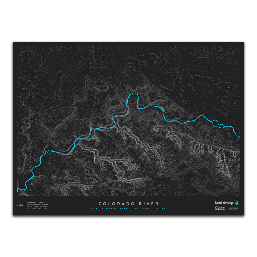
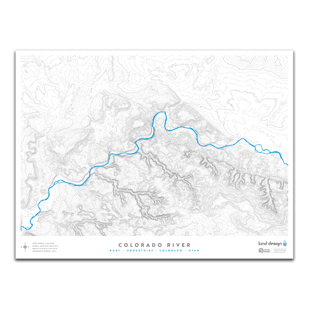
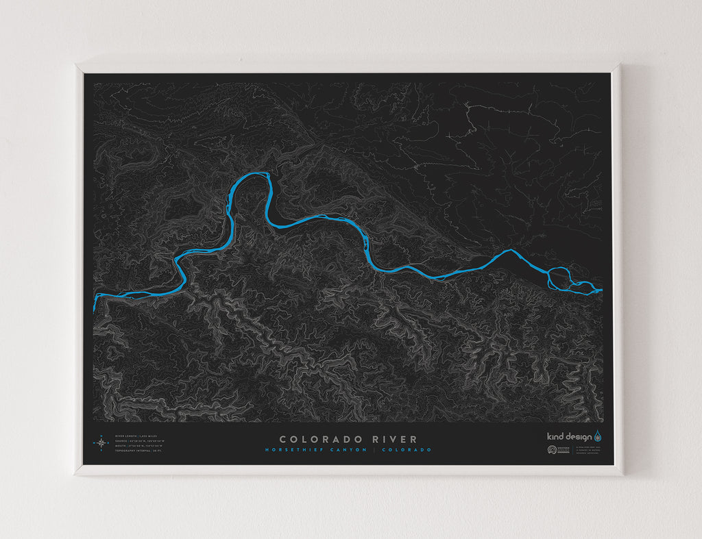
COLORADO RIVER / RUBY - HORSETHIEF
River Length: 1,450 Miles
Source: 40°28’20”N, 105°49’34”W
Mouth: 31°54’00”N, 114°57’03”W
Topo Interval: 75 Feet
Ruby Canyon and Horsethief Canyon is a beautiful section of the Colorado River just west of Grand Junction, flowing into Utah and ending at the Westwater Ranger Station.
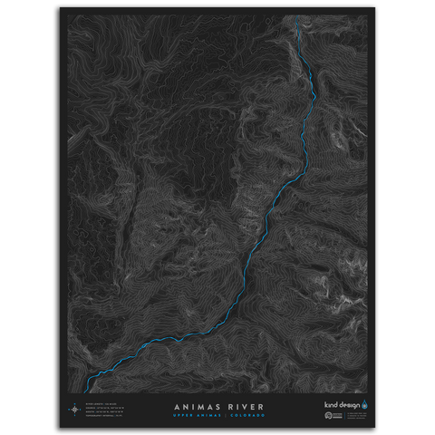
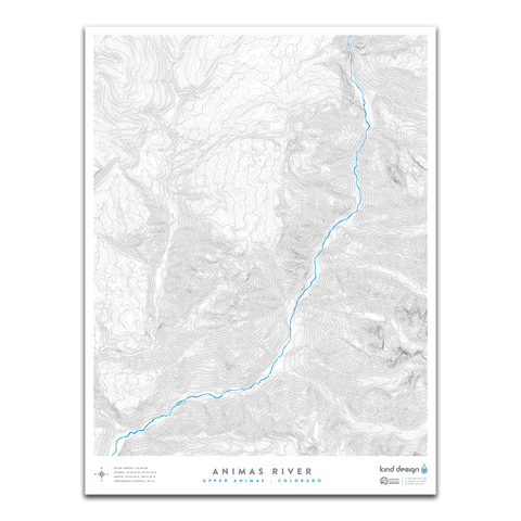
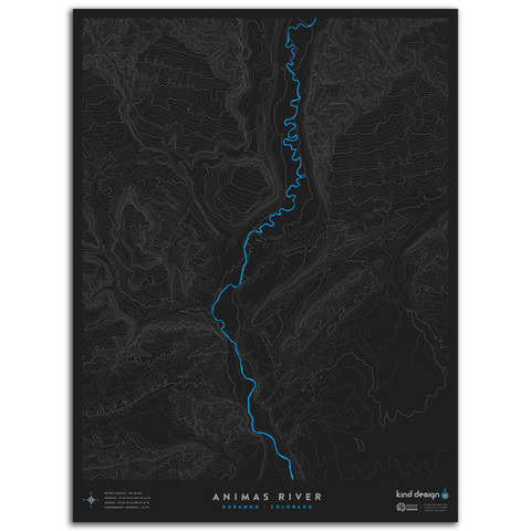
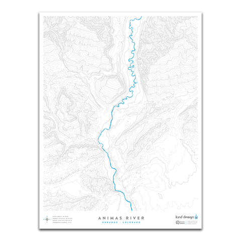
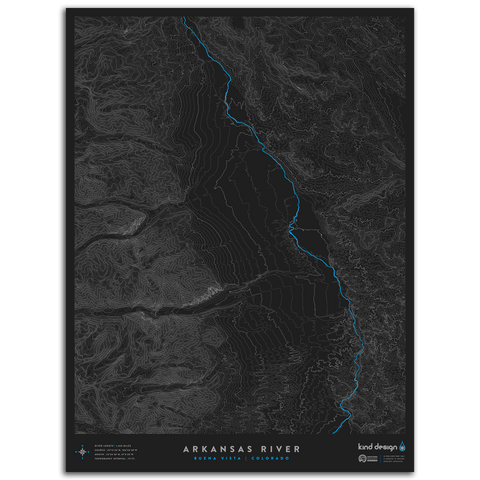
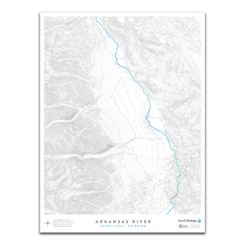
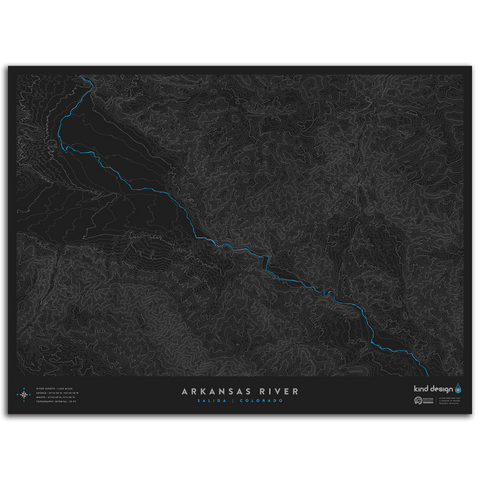
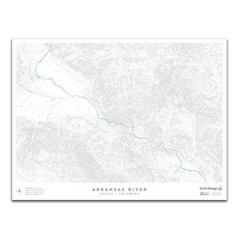
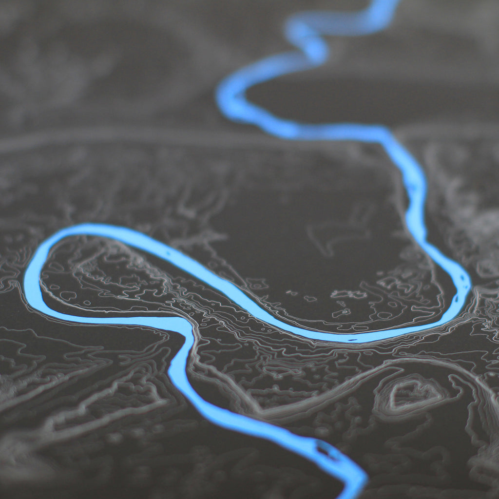
Our River Topo Maps feature accurate topographic & hydrographic data of rivers and creeks around the United States. Each print is carefully designed from scratch using a variety of techniques and real USGS data, creating unique artwork that you will not find anywhere else.
Each print is made in the U.S.A. using 100% cotton Moab Entrada archival quality paper with a slightly textured matte finish and exceptional color reproduction.
$2 from every print sold is donated to Western Resource Advocates, a 501(c)(3) nonprofit with a focus on protecting rivers and lakes across the west.
Each made-to-order print takes 7-10 days to print and ship.
We highly recommend framing prints immediately to avoid potential damage.